[Op-Ed] PARADOXES OF THE ANDEAN REGION OF COLOMBIA: URBAN PLANNING, ECONOMIC DEVELOPMENT, UNDERLYING CRISIS AND PEASANT ECONOMIES.
From the development paradigm, the extinction of the peasant economy was predicted, which, however, remains today and offers possible routes to face the food and clima
MÁS EN ESTA SECCIÓN
From the development paradigm, the extinction of the peasant economy was predicted, which, however, remains today and offers possible routes to face the food and climate crisis that underlie development. The paradigm of "development", emerging from the bowels of Western modernity, was proposed, at the end of the Second World War, as the “only possibility” to reconstruct the destroyed Europe, “organize” the independence movements of Asia and Africa and to the constitution of the new cities that emerged from decolonization on these continents.
The commitment to development becomes very valid in the post-war period to state that rural areas and underdevelopment are a problem of economic backwardness, which can only be overcome if underdeveloped countries become urban, developed and industrialized countries.
It is based on constitutive principles of Modernity, some of which today require reevaluation since they lead to environmental, social and economic crises:
Nature, previously sacred, is assumed to be infinite resources for exploitation to meet the unlimited needs of men (not women).
The rural as the backward that must be replaced by the city that is development.
Science and technology as the only paths at the service of modern man in his freedom and progress.
The predominance of the extractive and accumulation economy, supported by new techniques and energy sources based on hydrocarbons, coal, iron, mining, the opening of markets and the expansion of trade.
Market self-regulation as the unequivocally superior form of economic organization
“Free enterprise”, as, only route that guarantees progress, through wealth and prosperity.
The freedom of the individual, reason and progress as the principles on which society has been organized.
The prevalence of private property over the means of production and distribution.
The absolute belief in the exclusivity of reason to know the truth and that what is real must be experimentally verifiable
Ancestral knowledge, ancestral collective territories and property, declared obtuse and reduced to ostracism
The reinforcement of the patriarchal system.
Although, the path of development was established in its splendor in the decades of the 50s and until the mid-60s, at the end of the 60s and in the 70s, crises and rural movements began to appear that questioned it and demanded the rural as a vital stage of human existence. Although “development” has gradually been adapted from the centers of power to new interests, problems and challenges defined by geopolitics, with new institutional arrangements, policies, and development modalities, today it faces social, climate and food crises. Is urgently need to be unraveled and/or built new paradigms.
The rural, generically stated as a peasant economy, brings together indigenous, Afro-descendant and peasant production and life systems, as well as their thoughts, worldviews and productive practices in harmony with nature and culture, within the framework of agriculture for life and, It stands as a possibility to maintain spaces and relationships of reciprocity: human being-nature and to address the food crisis.
The Andean Region of Colombia is a paradox that should be known.
In the Andean region of Colombia, made up of 53.12% of the total departments of Colombia (Antioquia, Boyacá, Cauca, Caldas, Caquetá, César, Cundinamarca, Chocó, Huila, Nariño, Norte de Santander, Putumayo, Quindío, Risaralda , Santander, Tolima, Valle del Cauca), there are large and medium-sized cities: Bogotá D.C., Medellín, Cali, Bucaramanga, Cucuta, Neiva, Ibague, Valledupar as well as predominantly rural departments. One and the other make up the paradoxes of this region: Urbanism, hegemonic economic development with its crises and rural peasant economies that contain possible alternatives to these crises.
Boyacá, mostly rural with a smallholder peasant population, whose economy revolves around agricultural production and coal mining, but also with large emerald deposits, violently managed by “emerald bosses”; Cauca, with a mostly rural population, made up of peasants, Afro-descendants and indigenous people, with their own forms of organization and resistance and dedicated to agricultural production, but there is also a presence of mining and the expansion of illicit crops run by drug trafficking gangs that use violence for their activities; In Chocó, more than 50% is the predominantly Afro-descendant rural population, followed in order by the indigenous and peasant population. Its production is agricultural and small gold mining. However, also, the presence of national and multinational mining companies and illegal mining; In Nariño, the majority of the population, 57%, still lives in the rural area, dedicated to agricultural production, but also presented is the expansion of illicit crops run by drug trafficking gangs that use violence for their activities.
According to a study by the Agustín Codazzi Geographic Institute, IGAC, departments of the Andean region (Chocó, Valle del Cauca, Nariño, Antioquia) but also Casanare, Meta, and Guainía, reveal the persistent fragmentation, inequity and inequality in the distribution of land. The majority of the properties are “minifundiums” with biodiverse production systems that produce food, while a minority of owners own large areas dedicated mainly to agroindustrial monocultures and extensive livestock farming.
83.5% of the food that Colombians consume is produced by our farmers
What to know in the Andean region of Colombia?
I will not refer to the large cities that undoubtedly offer a diversity of places of interest, varied gastronomic offerings, but as Alejandra Pizarnik will express “how strangely the same are the cities of the West”, therefore, I will point out some endearing places in this region:
Catedral de sal de Zipaquirá:
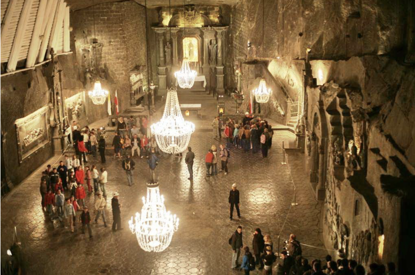
Photo 1. Catedral de sal de Zipaquirá. This photo is by an unknown author and licensed under CC BY-SA.
This mine is the largest reserve of rock salt in the world, located in the municipality of Zipaquirá, in the department of Cundinamarca and embedded in the Cerro del Zipa (maximum indigenous chief). It is a magnificent building 180 meters underground. “When entering the mine you can smell the mineral smell and darkness takes possession of everything. Afterwards, a play of light reveals the carved rock and the tunnels that house stations of the Stations of the Cross. At the end there is access to three naves: that of birth and baptism, that of life and death and that of the resurrection, each one with an altar.
Parque Nacional Natural los Nevados:
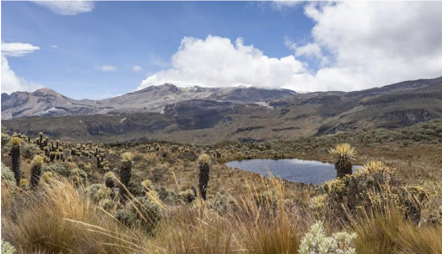
Photo 2. Parque Nacional Natural Los Nevados. Source: https://www.parquesnacionales.gov.co/nuestros-parques/pnn-los-nevados/
The Natural Park “Los Nevados” is located in the heart of the Coffee Region, in the northern volcanic complex made up of the Nevado del Ruiz volcano, “La Olleta” and “La Piraña” craters, the Nevado de Santa Isabel volcano, the Nevado del Tolima volcano, and the “Cisne”, “Santa Rosa” and “Quindío” paramos. The Protected Area was created in 1974.
CONTENIDO RELACIONADO
Parque Nacional Natural El Cocuy:
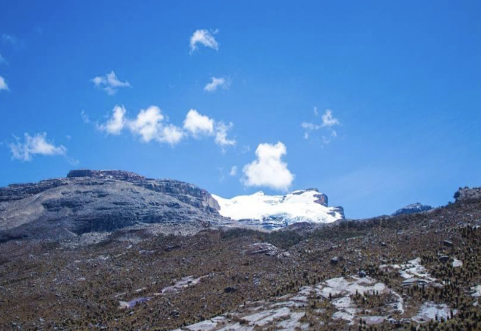
Photo 3. Parque Nacional Natural El Cocuy. Source: https://old.parquesnacionales.gov.co/portal/es/ecoturismo/parques/region-andina/
El Cocuy National Park, located northeast of the Eastern Cordillera of the Andes, between the departments of Arauca, Boyacá and Casanare, has an area of 306,000 hectares. On the western side, there is the Protected Area that begins at 4000 meters above sea level to the maximum crest of the mountain range at 5330 m.a.s.l; On the east side it ends at 600 m.a.s.l in the plain foothills of the departments of Arauca and Casanare. On the western side, a Sierra Nevada is located. For Ecotourism there is a General Outdoor Recreation Zone, which has 4,915.84 hectares, and represents 1.5% of the total area of the National Natural Park.
El Eje Cafetero:
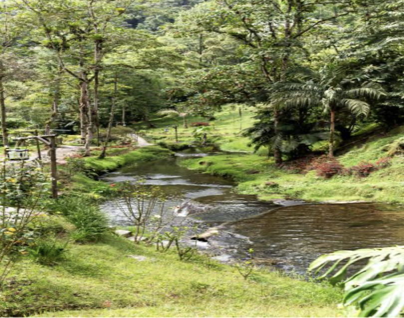
Photo 4. Eje cafetero en Colombia. Source: https://www.istockphoto.com/es/search/more-like-
The coffee axis of the Andean region is located between the departments of Risaralda and Quindío. In this area is the “coffee route”. Traveling along this route, you will be able to stay in peasant coffee farms, to learn about the production process of the best quality coffee in the world, wake up in the countryside and drink Colombian coffee, with that particular and exquisite aroma of one of the best coffees in the world.
El Macizo Colombiano:
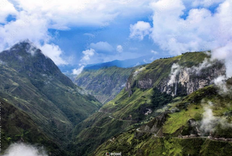
Photo 5. El Macizo Colombiano. Source: https://stock.adobe.com/images/foto-en-el-macizo-colombiano-nacimiento-de-los-rios-magdalena-patia-y-caqueta
The Colombian Massif, or “Nudo de Almaguer”, is the most important water star in Colombia, made up of a mountain range in the Andes, where the Magdalena, Patía and Caquetá rivers originate. It covers the departments of Huila, Cauca, Nariño and Putumayo, north of the Pastos node. “Ancestral and sacred territory, populated by Yanakuna indigenous communities and mestizo peasants (guardians of the lagoons and the moors); In the high areas of the core of the massif, the indigenous communities of the Yanakuna, Nasa and Kokonukos predominate.” (( https://www.google.com/search?q=Pueblos+ind%C3%ADgenas+)
La Laguna de Cocha:
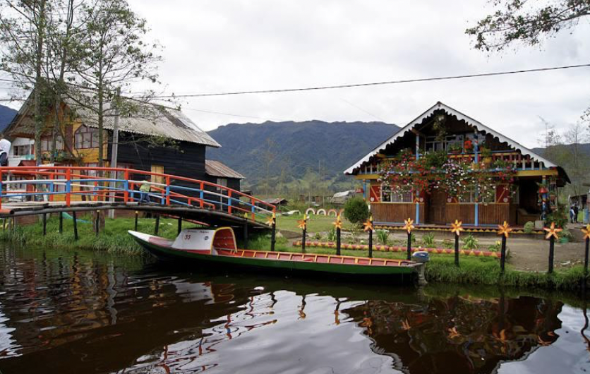
Photo 6. Laguna de Cocha. Source: https://www.google.com/search?gs_ssp=eJzj4tZP1zc
The “La Cocha” lagoon, also called Guamuez lake, is a large natural reservoir of glacial origin, located in the Colombian location of El Encanto, a district of the municipality of Pasto, in the department of Nariño. It is the second largest natural body of water in the nation, after Lake Tota. Peasant organizations have organized a proposal for ecological rural tourism in this place.




DEJE UN COMENTARIO:
¡Únete a la discusión! Deja un comentario.