THE CARIBBEAN REGION OF COLOMBIA IS A BEAUTIFUL AND COMPLEX PARADOX THAT MUST BE LIVED AND FELT
MÁS EN ESTA SECCIÓN
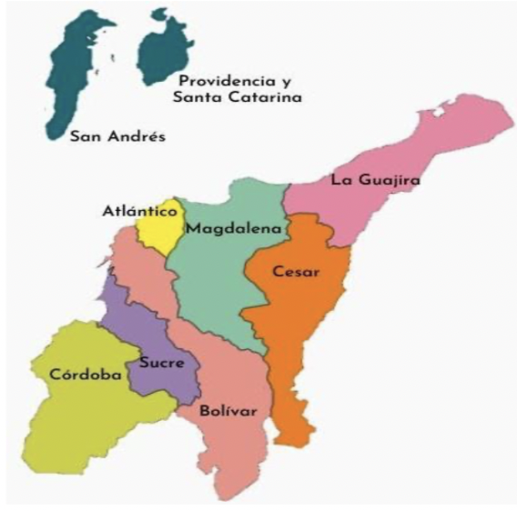
Map of the departments of the Caribbean region of Colombia. Source: Wikimedia Commons
The Caribbean region bathed by the sea of the same name is the northernmost continental and maritime natural region, located in the northern part of Colombia. The sea, savannas, plains and mountains intertwine and constitute a great diversity of landscapes and natural riches with a great diversity of landscapes and natural riches that range from 0 to 5,730 meters above sea level with snow-covered mountains.
In this region, also known as the Atlantic Coast, indigenous peoples live: Arhuaco, Kogi, Wiwa, Kankuamo, Chimila, Emberá Katío, Mokaná, Zenú, Tule and Wayuu; Afro-descendant peoples who escaped slavery and live in “Palenque”: San Basilio de Palenque (Mahates – Bolívar); - San José de Uré (Córdoba); - Jacobo Pérez Escobar (Magdalena) and La Libertad (Sucre); mestizo peasant population and mestizo population of the elites who call themselves “white.” Also, there is an “Arab” population called generically “Turkish”, with an important presence in Lorica, department of Córdoba jokingly referred to as “Lorica Saudi” and in Barranquilla, department of Atlántico.
Feeling and living the Caribbean Region means intense blue sea, white sand beaches, the highest coastal mountain in the world with its lost city. They are desert and sea intertwined in La Guajira. Is Punta Gallinas, the northernmost point of South America. It is the “pink flamingo” flora and fauna sanctuary. They are sand dunes, savannahs, plains, volcanoes of mud and ash and it is the complexity because as in all of Colombia, violence is also expressed in this region.
In a context of economic, social and political asymmetries, tensions arise between elites and peasant, indigenous and Afro-descendant populations, as well as popular struggles and resistance and violence promoted by armed actors (guerrillas, paramilitaries) and criminal gangs of illicit economies (drugs and mining). ) articulated to global multicrime dynamics. However, and despite violence that seems like the tragic fate of Colombia's history, there is progress towards the construction of Peace, which allows us to dream of building hope and possibilities of feeling and living in the region, following guidelines from the Ministry of Tourism and local populations.
In this article, I invite you to join me on a possible trip, to know the Sierra Nevada de Santa Marta and its “lost city.”
The Sierra Nevada de Santa Marta is the highest coastal mountain in the world, occupying the departments of Magdalena, La Guajira and Cesar. It has all the thermal levels, from the warm dry to the perpetual snow from whose melting lakes and rivers are born. In 1979, UNESCO declared the Sierra “a Biosphere Reserve and a World Heritage Site”.
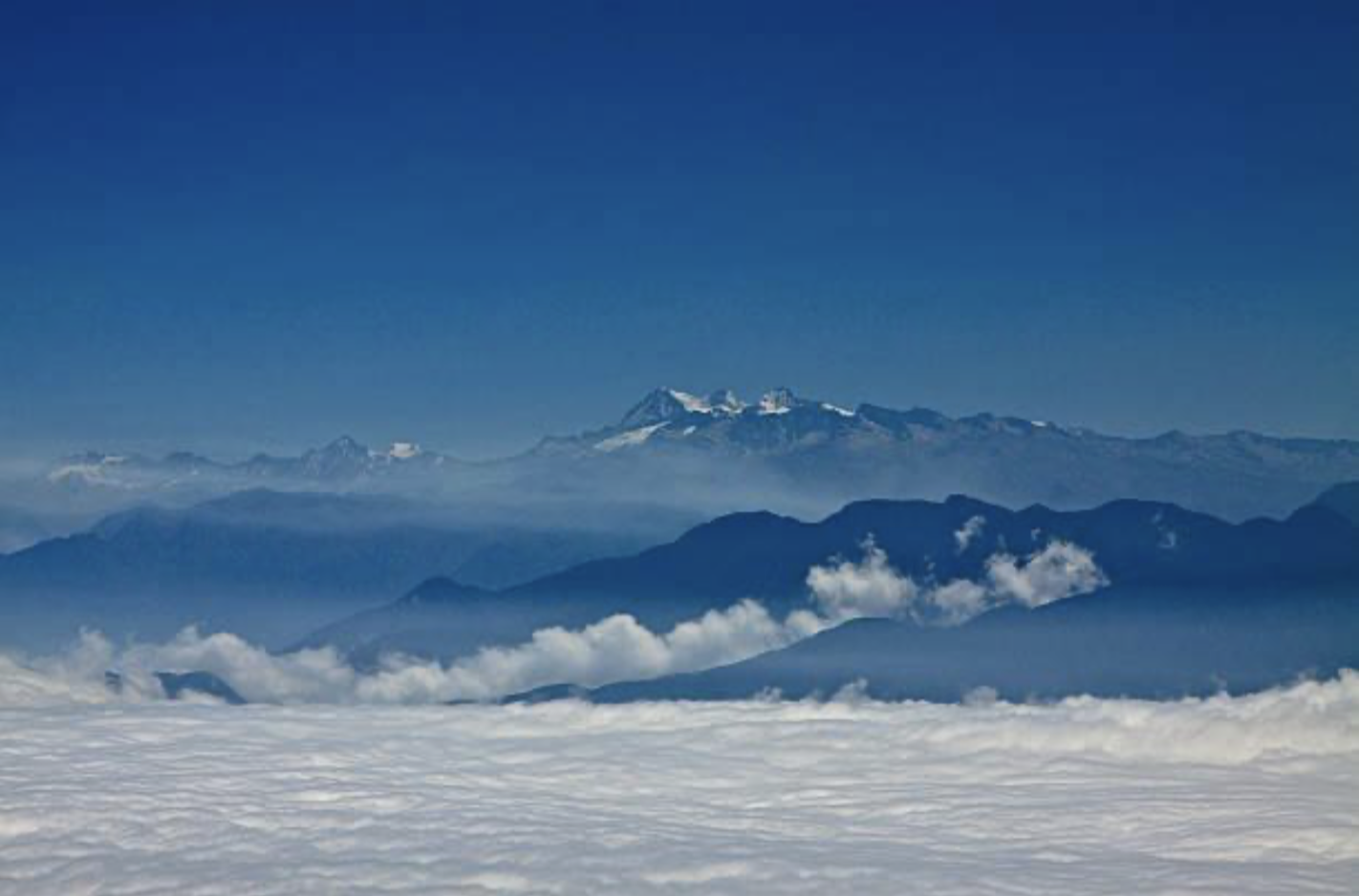
Photo 1. Sierra Nevada de Santa Marta, from the sea to snow-capped peaks. Photo author: https://www.gettyimages.es/detail/foto/sierra-nevada-de-santa-marta-imagen-libre-de-derechos
The adventure begins by car in the city of Valledupar and continues to "Nabusimake", an Arhuaco settlement, whose name translates as the place where the Sun is born. From there, a tour of trails leads to lakes and glaciers located at 3,000 meters above sea level. Just 42 kilometers from the warm beaches of the Colombian Caribbean, there is a wonderful landscape of perpetual highest snow, with two peaks of the Sierra: Colón and Bolívar, located at 5,730 meters above sea level. Around the rivers, live countless birds and howler monkeys that, with their sounds, are part of "the soundtrack of. the saw ((https://colombia.travel/es/santa-marta/descubre-los-encantos-de-la-sierra-nevada-de-santa-marta)
The Lost City known as “Buritaca-200” or Teyuna Archaeological Park, is located in the Sierra Nevada. Its discovery was officially registered in 1976 and it is one of the main archaeological sites in Colombia. Built by the Tayrona indigenous people around the year 700, it still shows us what were its circular plazas, stairs, paths and canals built in stone that served as a base for homes made of straw and bahareque.
What is surprising about Ciudad Perdida is the complexity of its architecture, which included a system of canals to carry rainwater to the towns and terraces to preserve soil fertility. There are also cave paintings and petroglyphs.
CONTENIDO RELACIONADO
Although the Tayrona indigenous people are extinct, their culture is still expressed through four towns, Kogui, Arhuacos, Wiwa and Kankuamo
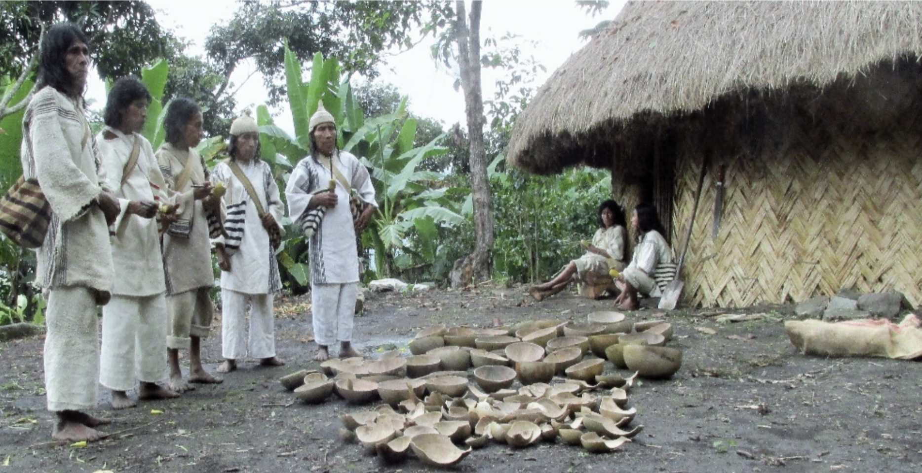
Photo 2. Kogi indigenous people. Photo author: https://old.parquesnacionales.gov.co/portal/es/desarrollo-local-sostenible/multimedia
The Kogi or Kágaba, which means "people" in their language, are defined as the older brothers to whom “Kakü Serankua”, the god of the universe, recommended to take care of nature and show the “younger brothers”, the non-indigenous, paths of harmony, respect for nature, solidarity and affection for all human and natural living beings. They, in the present, are also the guardians of the “lost city”.
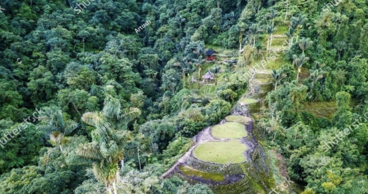
Photo 3. Lost City in the Sierra Nevada de Santa Marta. Photo author: https://www.shutterstock.com/es/image-photo/hidden-ancient-ruins-tayrona-civilization-ciudad-2455735285
In the eighties, of the 20th century, I walked part of my life with the Kogi and Arhuacos in the Sierra Nevada de Santa Marta. I was supporting, with other women and men what was then called the “Bicultural Education” process. From our youth and enthusiasm, we dream and contribute to the construction of a possible dream, that of the dignity and respect of natural and human life.
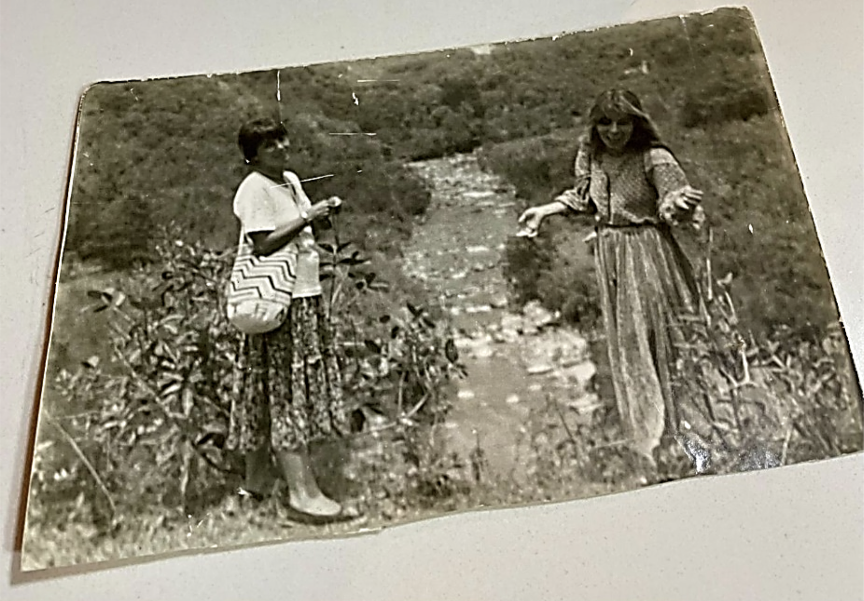
Photo 4: Elvira Alvarado and Lucía Vásquez Celis (on the right), in the San Sebastián de Nabusimake river. 1985. Own photo



DEJE UN COMENTARIO:
¡Únete a la discusión! Deja un comentario.